Mapping Community Recovery and Urban Resilience in Ohio with Trinity Pro

Cleartopia Solutions™ is a U.S.-based drone solutions provider specializing in advanced aerial hardware, software, and strategic support for public and private sector clients. The company focuses on delivering next-generation tools that enhance safety, planning, and innovation.

In August 2025, Cleartopia conducted a large-scale aerial mapping mission for the Village of East Palestine, Ohio, in support of recovery and redevelopment efforts following the Norfolk Southern train derailment that occurred in February 2023. The incident prompted long-term environmental and infrastructure planning initiatives, where accurate aerial data became essential to rebuilding community trust and safety. Using the Quantum Systems Trinity Pro, the team created the most comprehensive and detailed digital map of the village to date.

Project Specifications

Altitude

400 ft

Flight Time

7 hours of total flying (over 2 days)

Images Takes

10000 +

Drone

Trinity Pro

Camera

Sony ILX-LR1 and Phase One P5

Area Surveyed

5000 + acres

Wind Speed

8.5m/s | 20mph

Temperature

30° C

Challenges

The Village of East Palestine faced the need for cost-effective, high-resolution mapping to support long-term recovery, infrastructure planning, and environmental monitoring. Traditional aerial mapping, often requiring fixed-wing aircraft, can cost up to $75,000 per project and involve long turnaround times. For a small community recovering from a disaster, this approach was neither financially nor operationally sustainable.

Our Solution

Cleartopia deployed the Quantum Systems Trinity Pro eVTOL UAV to conduct large-scale aerial mapping of East Palestine. Using Trinity Pro’s long endurance and survey-grade payload, the team was able to map more than 5,000 acres in just two days, producing over 500GB of actionable data — at a fraction of the cost of traditional aerial mapping solutions, which can run up to $75,000 per project.

This provided East Palestine with the foundation for a comprehensive digital map that municipal staff could directly use for planning, safety, and recovery operations.

The Quantum Systems Trinity eVTOL is going to be the perfect mapping platform for local governments to get this type of accurate and high-fidelity data with its reliability, ease of use, and robust sensor options as well.
Trent Casi, Co-Founder at Cleartopia Solutions
Designer

Mission Execution

The Trinity Pro was flown by Cleartopia Solutions over the Village of East Palestine with town approval and full compliance with FAA regulations. Flights were conducted with visual observers positioned throughout the area to maintain Visual Line of Sight (VLOS).

The project area was divided into multiple flight zones to ensure safe operations and complete coverage. In total, Cleartopia mapped over 5,000 acres in just two days, collecting more than 500GB of high-resolution data — all provided to the city at no cost as part of Cleartopia’s community support initiative.

Results & Benefits

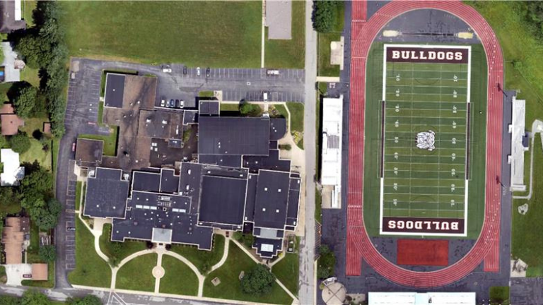
The mission produced a highly detailed digital map of East Palestine, with orthomosaic imagery at 1.8 cm GSD, along with a contour map, DSM, and point cloud. This data is already being used by the Village for:

  • Park development planning
  • Paving schedule optimization
  • Environmental recovery projects

The Village now owns the full dataset, which can be reused across multiple projects and departments. Future re-flights can also build on this baseline, ensuring consistent comparisons over time.

Data Processing & Results

The baseline dataset generated with Trinity Pro is already supporting city planning, economic development, park design, paving schedules, and environmental recovery initiatives in East Palestine.

Data deliverables — including orthomosaics, DSMs, and layered vector maps- were processed using ESRI web-based systems, ensuring that all departments can access and use the information collaboratively.

The City Planning and Economic Development departments are the primary users of the data, integrating it into long-term infrastructure and redevelopment planning. This centralized access enables faster, data-driven decision-making across projects and reduces reliance on external surveys.

As new projects emerge, the dataset can be updated and reprocessed to reflect changes in the city landscape, ensuring that the mapping remains a living reference for recovery, planning, and growth.

Conclusion

The East Palestine mission demonstrates how small communities can leverage Quantum Systems’ Trinity Pro to gain the same level of aerial intelligence as major cities. This is being done at a fraction of the cost, driving smarter recovery, safer communities, and new opportunities in education.

The project also reflects how private-sector drone providers can collaborate with local governments in times of crisis, offering advanced aerial mapping capabilities at no cost to support recovery, transparency, and long-term community planning.

Download this use case

Urban Infrastructure & Disaster Recovery_Trinity Pro_Use Case

pdf
3.83 MB

MORE USE CASES