Scaling Drone Operations: How Aero Velocity Uses Trinity Pro for Forestry and Farmland Projects

The future of forestry and farmland management depends on speed, precision, and scalability. Traditional land surveying methods are time-intensive, limited in scope, and difficult to execute in challenging terrain. For Aero Velocity – a U.S.-based leader in drone services partnering with agencies such as the United States Department of Agriculture (USDA), the Natural Resources Conservation Service (NRCS), and the U.S. Forest Service – these limitations once constrained how quickly projects could scale. 

That changed with the adoption of the Quantum-Systems Trinity Pro VTOL fixed-wing drone, which has redefined Aero Velocity’s ability to deliver large-scale, high-resolution data with unmatched speed and reliability. 

In a recent webinar with Quantum Systems, Aero Velocity’s Chief Pilot, Seth Allen, and Marketing Manager, William Gilliland, shared how the Trinity Pro has transformed their operations. By adding the Trinity Pro to its fleet, Aero Velocity can now map hundreds of acres in a single flight, triple efficiency compared to multirotors, and deliver high-quality data for critical land monitoring projects. 

Project Specifications

Altitude

80 m AGL

Drone

Trinity Pro

Camera

QUBE 640

Wind Speed

8.6m/s

The Challenge: Scaling Beyond Multirotors 

Aero Velocity operates across farmland, forests, and conservation projects — environments that are large, complex, and often difficult to access. With traditional multirotor drones, a single site could require a dozen or more flights. 

As Aero Velocity’s Chief Pilot Seth Allen explained during the webinar, that level of inefficiency wasn’t sustainable as Aero Velocity’s government and commercial project pipeline grew. The Trinity Pro changed the equation. 

For Aero Velocity, the question wasn’t just about speed – it was about scaling up to meet the growing demands of their government and private sector clients. 

“We scanned one farmland property with a multirotor, and it took 12–13 flights. The next year, we covered that same property with the Trinity Pro in just 2 or 3 flights. That efficiency gain alone changed the way we approach projects.”.
Seth Allen, Chief Pilot at Aero Velocity
Designer

Why Trinity Pro? 

To scale effectively, Aero Velocity needed a platform that could cover more ground, perform reliably in tough environments, and remain accessible to new pilots joining their team. 

The Trinity Pro delivered on all fronts: 

  • VTOL flexibility – Able to take off in tight or uneven terrain and transition smoothly to fixed-wing flight. 
  • Endurance – Up to 60 minutes of flight time, allowing up to 304 acres in a single flight. 
  • Terrain following – Essential for projects in mountainous forests and valleys, ensuring data quality and safe flight paths. 
  • Payload efficiency – Supporting LiDAR sensor, this gave Aero Velocity the flexibility to adapt to each mission. 
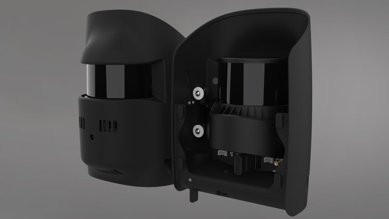
  • Qube 640 (LiDAR): their primary payload for forestry mapping, conservation monitoring, golf courses, and infrastructure inspections.  
  • Training readiness – Intuitive systems made Trinity Pro one of the best training platforms for Aero Velocity’s new pilots.  

Mission Highlights 

The U.S. Forest Service Project – Georgia 

  • Dense forest and mountainous terrain made for one of Aero Velocity’s toughest projects. 
  • Terrain-following autonomy ensured smooth transitions and safe flight paths. 
  • Qube 640 LiDAR payload enabled detailed mapping of sensitive Montane bog ecosystems without disturbing the delicate landscape. 

USDA-NRCS Mississippi Farmland (15,000+ acres scanned) 

  • Multispectral imaging with the support of Micasense Altum PT provided insights into crop health and irrigation planning, while the Trinity Pro cut flight counts by over 70%, delivering critical data for precision irrigation strategies that reduce water use by 20–40%.  
  • A multirotor previously required 12–13 flights to scan a certain property. 
  • The Trinity Pro reduced this same property to just 2–3 flights, tripling efficiency. 

Additional Projects 

  • Mapping golf courses, airport runways and taxiways, and dams.  

Market Impact: Efficiency, Scale, and Trust 

The Trinity Pro has become a cornerstone of Aero Velocity’s growth strategy, allowing the company to: 

  • Triple efficiency compared to multirotors. 
  • Map up to 304 acres per flight, scaling data collection like never before. 
  • Deliver research-grade results trusted by federal agencies and private sector clients alike. 
  • Expand project opportunities, from agriculture to conservation and infrastructure. 

Looking Ahead 

For Aero Velocity, Trinity Pro has not only improved efficiency but also unlocked opportunities to win new projects and expand into conservation and government-backed land monitoring. 

As William Gilliland noted, the combination of long-range endurance, payload flexibility, and operational ease has positioned Aero Velocity to scale confidently: 

“Aero Velocity has taken the steps needed to expand into beyond visual line of sight (BVLOS) operations. When paired with the capabilities of the Trinity Pro, this advancement gives us a market-leading edge and strengthens our role as the trusted partner for agencies and organizations facing today’s most urgent land management challenges.” 

Looking forward, Aero Velocity sees drone technology becoming even more integrated with AI-driven analytics and advanced land monitoring workflows, supporting sustainability and operational readiness across sectors. 

Conclusion 

Aero Velocity’s journey shows how the Trinity Pro is more than a drone — it’s a force multiplier for efficiency, precision, and scalability. From supporting USDA-NRCS projects that help farmers in Mississippi, to enabling the U.S. Forest Service to monitor Montane bog ecosystems without disruption, Aero Velocity has proven how advanced drone technology directly supports sustainability, conservation, and smarter land management.  

For agencies, universities, and enterprises seeking scalable drone solutions, Aero Velocity offers the expertise and technology to deliver. With the Trinity Pro as part of its fleet, Aero Velocity is not just keeping up with demand — it’s setting the standard for the future of aerial data. 

MORE USE CASES