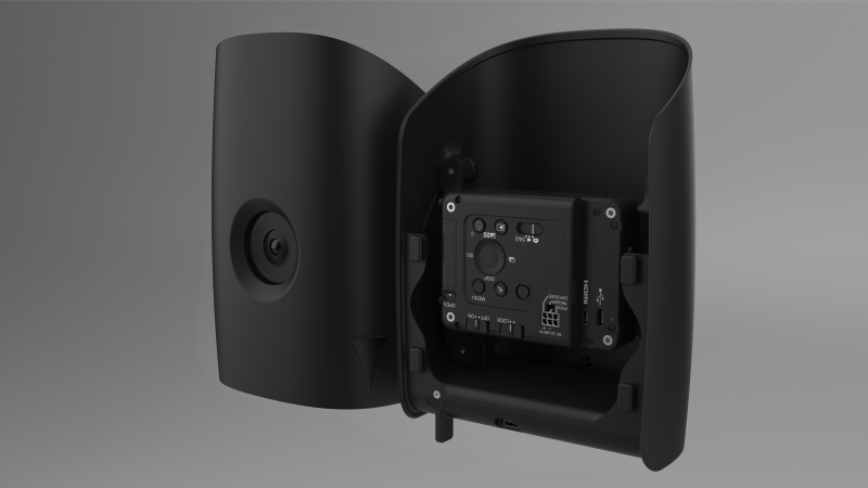
Phase One P5
RGB Camera
The Phase One P5 stands as the world’s pioneering GIS mapping sensor with a 128-megapixel resolution that delivers unprecedented image detail and resolution down to 0.1/0.3 inch RMS XY/Z* absolute accuracy. When paired with Trinity Tactical, the unprecedented image resolution and low GSD of the P5 allows operators to collect reliable, accurate spatial data at a greater altitude for inaudible flight. The electronic global shutter, combined with metrically calibrated lense and sensor, reduces the necessity for extensive software corrections caused by pixel distortion, ensuring the preservation of high-quality data.
Technical Specifications
Sensor resolution
128 MP
Sensor Type
CMOS
Sensor Format
Medium Format
Shutter Type
Electronic Global Shutter
Dynamic Range
80 dB
Max Frame Rate
4 fps
Storage
CF Express Card up to 2TB
Lens Options
80 mm (HFOV: 32° VFOV: 23)
35 mm (HFOV: 66° VFOV: 49)
80 mm Option
GSD @60m
0.1 in (0.26 cm)/px
GSD @120m
0.2 in (0.52 cm)/px
Coverage @60m AGL
165 acres (0.1 in/px GSD, 70% overlap)
67 ha (0.26 cm/px GSD, 70% overlap)
Coverage @120m AGL
333 acres (0.2 in/px GSD, 70% overlap)
135 ha (0.51 cm/px GSD, 70% overlap)
35 mm Option
GSD @60m
0.23 in (0.59 cm)/px
GSD @120m
0.46 in (1.18 cm)/px
Coverage @60m AGL
380 acres (0.23 in/px GSD, 70% overlap)
154 ha (0.59 cm/px GSD, 70% overlap)
Coverage @120m AGL
763 acres (0.09 in/px GSD, 70% overlap)
309 ha (1.18 cm/px GSD, 70% overlap)
Sample Data
Flight altitude
197 ft (60m)
Flight speed
40 mph (18 m/s)
GSD
0.1 in (0.26 cm)/px
Images
1,804
Flight time
12.40 min
Area
34 acres (14 ha)